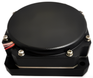
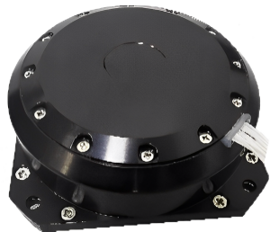
Type 100 Rotary Fiber Strapdown Inertial Navigation System

Product description
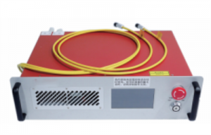
Introducing the FS100, a comprehensive system designed to provide high-precision measurement and control capabilities. This advanced system comprises several key components, including the Inertial Measurement Unit (IMU), Rotation Mechanism, Navigation Computer, GNSS Board, Navigation Software, DC Power Supply, and Mechanical Components.
The IMU, a crucial component of the FS100, consists of three high-precision fiber optic gyroscopes, three quartz flexure accelerometers, a navigation computer, a secondary power supply, and a data acquisition circuit. Leveraging a high-precision closed-loop fiber optic gyroscope, accelerometer, and high-end GNSS receiver board, the FS100 system employs cutting-edge multi-sensor fusion and navigation algorithms to deliver exceptional accuracy in attitude, velocity, and position information.
The FS100 system caters to various high-precision measurement and control requirements across multiple applications. Its key application areas include:
Large UAV Reference Inertial Guidance: The FS100 provides precise inertial guidance capabilities for large unmanned aerial vehicles (UAVs), ensuring optimal navigation and control.
Marine Compass: With its high precision and stability, the FS100 serves as an ideal compass solution for marine applications.
Self-Propelled Artillery Orientation: The FS100 system offers accurate orientation capabilities for self-propelled artillery systems, enabling precise targeting and control.
Vehicle-Based Positioning and Orientation: Utilizing the FS100, vehicles can achieve precise positioning and orientation, enhancing navigation and control in diverse environments.
High-Precision Mobile Measurement: The FS100 excels in high-precision mobile measurement scenarios, delivering accurate and reliable measurement data for a wide range of applications.
High-Precision Stable Platform: With its exceptional stability and precision, the FS100 is a perfect fit for high-precision stable platform applications, ensuring reliable and accurate performance.
Experience the pinnacle of high-precision measurement and control with the FS100, a comprehensive solution designed to meet the most demanding requirements in various industries.
MAIN FUNCTION
The system has combined inertial/satellite navigation mode and pure inertial mode.
Inertial guide built-in GNSS board, when GNSS is effective inertial guide can be combined with GNSS for navigation, and provide the combined position, altitude, speed, attitude, heading, acceleration, angular velocity and other navigation parameters to the user, while outputting GNSS position, altitude, speed and other information.
When GNSS is invalid, it can enter the pure inertial mode (i.e., it has never performed GPS fusion after power on, and if it loses lock again after fusion, it belongs to the combined navigation mode) After starting, it has accurate attitude measurement function, can output pitch and roll heading, and pure inertial can be static north finding.
The main functions include
l initial alignment function: inertial guide power on and wait for the satellite information is valid, the satellite is valid for 300s alignment, alignment is completed after the transfer to the combined navigation state inertial guide;
l combined navigation function: immediately after the initial alignment into the combined navigation state, inertial guidance using the internal GNSS board for combined navigation, can solve the carrier speed, position and attitude and other navigation information;
l communication function: the inertial guide can output inertial guidance measurement information to the outside according to the protocol;
l with the ability to upgrade software in situ on board: the navigation software can be upgraded through the serial port;
l with self-detection capabilities, when the system failure, able to send invalid, warning information to the relevant equipment;
l with wobble alignment function.
The inertial guidance workflow is shown in Figure 1 below.
Figure 1 Inertial guidance workflow diagram
PERFORMANCE INDEX
|
Item |
Test conditions |
A0 indicator |
B0 Indicator |
|
|
Positioning Accuracy
|
GNSS valid, single point |
1.2m(RMS) |
1.2m(RMS) |
|
|
GNSS valid, RTK |
2cm+1ppm(RMS) |
2cm+1ppm(RMS) |
||
|
Position Hold (GNSS invalid) |
1.5nm/h(50%CEP), 5nm/2h(50%CEP) |
0.8nm/h(CEP), 3.0nm/3h(CEP) |
||
|
Heading accuracy
|
Self-seeking north |
0.1°×sec(Lati), Lati indicates latitude (RMS), 10min |
0.03°×sec(Lati), static base 10min alignment; where Lati indicates latitude (RMS) |
|
|
Heading hold (GNSS disabled) |
0.05°/h(RMS), 0.1°/2h(RMS) |
0.02°/h(RMS), 0.05°/3h(RMS) |
||
|
Attitude accuracy
|
GNSS valid |
0.03°(RMS) |
0.01°(RMS) |
|
|
Attitude hold (GNSS disabled) |
0.02°/h(RMS), 0.06°/2h(RMS) |
0.01°/h(RMS), 0.03°/3h(RMS) |
||
|
Velocity accuracy
|
GNSS valid, single point L1/L2 |
0.1m/s(RMS) |
0.1m/s(RMS) |
|
|
Speed hold (GNSS disabled) |
2m/s/h(RMS), 5m/s/2h(RMS) |
0.8m/s/h(RMS), 3m/s/3h(RMS) |
||
|
Fiber optic |
Measurement range |
±400°/s |
±400°/s |
|
|
Zero bias stability |
≤0.02°/h |
≤0.01°/h |
||
|
Quartz Flexure Accelerometer |
Measurement range |
±20g |
±20g |
|
|
Zero-offset stability |
≤50µg (10s average) |
≤20µg (10s average) |
||
|
Communication interface
|
RS422 |
6 way Baud rate 9.6kbps~921.6kbps, default 115.2kbps Frequency up to 1000Hz (original data), default 200Hz |
||
|
RS232 |
1 way Baud rate 9.6kbps~921.6kbps, default 115.2kbps Frequency up to 1000Hz (original data), default 200Hz |
|||
|
Electrical Characteristics
|
Voltage |
24~36VDC |
||
|
Power consumption |
≤30W |
|||
|
Structural characteristics
|
Dimension |
199mm×180mm×219.5mm |
||
|
Weight |
6.5kg |
≤7.5kg (non-airline type) ≤6.5kg (aviation type optional) |
||
|
Operating Environment
|
Operating Temperature |
-40℃~+60℃ |
||
|
Storage temperature |
-45℃~+65℃ |
|||
|
Vibration (with damping) |
5~2000Hz,6.06g |
|||
|
Shock (with damping) |
30g,11ms |
|||
|
Reliability |
Life time |
>15 years |
||
|
Continuous working time |
>24h |
|||