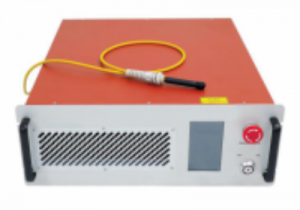
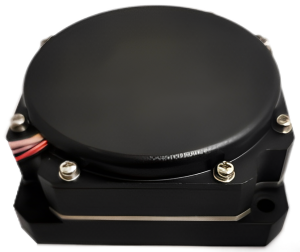
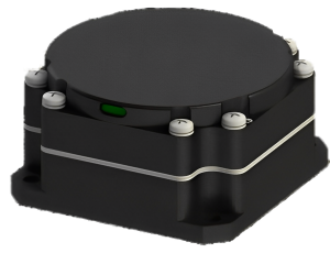
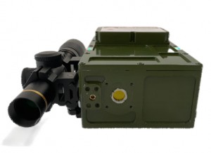
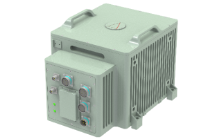
Type 50 Fiber Strapdown Inertial Navigation System

Product description
Type 50 Optical Fiber Integrated Navigation System, a cutting-edge solution meticulously engineered to provide unrivaled performance. This system encompasses a compact and lightweight three-axis integrated closed-loop fiber optic gyroscope, accelerometer, and guidance card, offering exceptional cost-effectiveness. Leveraging advanced multi-sensor fusion and navigation algorithms, it delivers precise measurements of attitude, heading, and position information with remarkable accuracy.
Designed with versatility in mind, the Type 50 system finds its perfect application in medium to high precision mobile measurement systems and medium to large unmanned aerial vehicles (UAVs). Its seamless integration and reliable performance make it an invaluable asset for various industries, including surveying, mapping, aerial photography, and more.
Experience the pinnacle of navigation technology with the Type 50 Optical Fiber Integrated Navigation System, enabling you to unlock new levels of precision and efficiency in your operations.
MAIN FUNCTION
The system offers a combined inertial/satellite navigation mode and a pure inertial mode.
In the inertial/satellite integrated navigation mode, the internal GNSS receiver uses the satellite positioning information for integrated navigation and outputs the carrier’s pitch, roll, heading, position, speed, and time information. When the signal is lost, the output includes the position, velocity, and attitude calculated by inertia, with a requirement to maintain accurate pitch and roll, along with a short-term course holding function and meter-level positioning accuracy.
The pure inertial mode (no GPS fusion occurs after powering on, and if lock is lost again after fusion, it enters the integrated navigation mode) features an accurate attitude measurement function, and can output pitch, roll, heading, and perform static north searching based on pure inertia.
PERFORMANCE INDEX
|
Project |
Test condition |
Index |
|
Positioning accuracy |
GNSS works, a la carte |
1.5m |
|
GNSS is valid, RTK |
2cm+1ppm |
|
|
Pure inertial horizontal positioning (Alignment efficiency) |
80m/5min(CEP) 500m/10min(CEP) 1.5nm/30min(CEP) |
|
|
Airspeed combination horizontal positioning hold (It is used on board, and there is turning maneuver before airspeed combination. The test takes 150km/h flight speed as an example, and the wind field is stable) |
0.8nm/30min (CEP) |
|
|
Course accuracy |
Single antenna (RMS) |
0.1° (Vehicle conditions, need to maneuver) |
|
Dual antenna (RMS) |
0.2°/L (L is the baseline length) (RMS) |
|
|
Course keeping (RMS) |
0.2°/30min(RMS),0.5°/h |
|
|
Self-seeking north accuracy (RMS) |
0.2°SecL, dual alignment for 15min 1.0°SecL, unit for 5-10 minutes |
|
|
Attitude accuracy |
GNSS valid |
0.02°(RMS) |
|
Attitude retention (GNSS failure) |
0.2°/30min(RMS),0.5°/h(RMS) |
|
|
Velocity accuracy |
GNSS valid, single point L1/L2 |
0.1m/s(RMS) |
|
Gyroscope |
Measuring range |
±400°/s |
|
Zero bias stability |
≤0.3°/h |
|
|
Accelerometer |
Measuring range |
±20g |
|
Zero bias stability |
≤100µg |
|
|
Physical dimensions and electrical characteristics |
Voltage |
9-36V DC |
|
Power consumption |
≤12W (steady state) |
|
|
I Interface |
2 channel RS232,1 channel RS422,1 channel PPS (LVTTL/422 level) |
|
|
Dimension |
92.0 mm×92.0mm×90.0mm |
|
|
Environmental characteristics |
Operating temperature |
-40℃~+60℃ |
|
Storage temperature |
-45℃~+70℃ |
|
|
Vibration |
5~2000Hz, 6.06g(with shock absorption) |
|
|
Impact |
30g, 11ms(with Shock absorption) |
|
|
Life span |
>15 years |
|
|
Continuous working time |
>24h |